by Kevin M. Johnston Ph.D. Esri
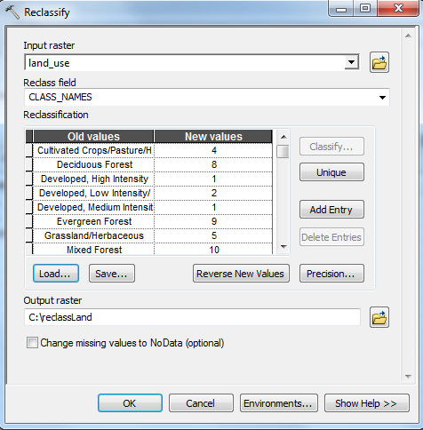
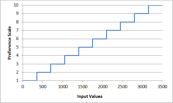
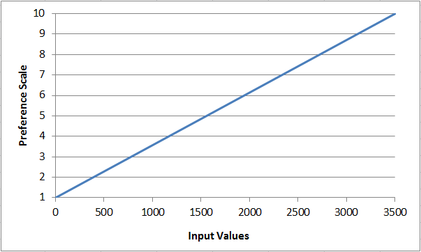
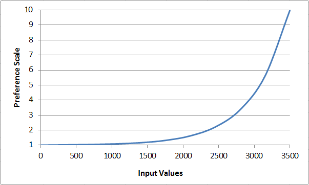
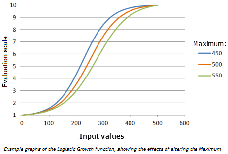
This story maps provides an overview on Reclassify and Rescale by Function, two tools commonly used to transform values.
Add why do you transform values in a suitability model.
Add what is categorical versus continuous data
Add link to case study