This story maps provides an overview on Reclassify and Rescale by Function, two tools commonly used to transform values.
Reclassify and Rescale by Function:
Tools for Data Transformation
Transforming Categorical Data
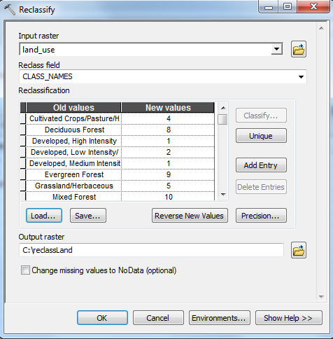
The Reclassify tool (Spatial Analyst toolbox) generally takes categorical input, such as types of land use, and assigns values onto a common scale.
Click here to see the land use values that have been transformed on a scale of 1 (red) to 10 (green).
In this model, developed land is regarded as less suitable (red) and receives a low value through reclassification. Forest land, on the other hand, is more suitable within this example and is transformed into higher values (green).
Transforming Continuous Data
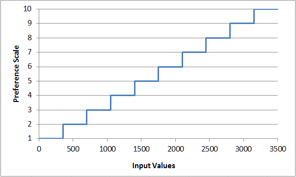
The Reclassify tool can also take continuous input, such as distance from roads, and assigns values onto a common scale.
Notice how discrete classes within the Reclassify tool create a stair-step effect within continuous data values. This approach may be helpful if class break points have been established.
Incorporating Linear Functions
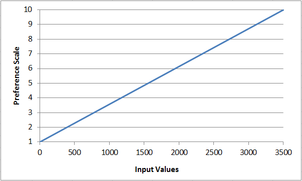
The Rescale by Function tool (Spatial Analyst toolbox) takes continuous input, such as distance from roads, and assigns values onto a common scale.
Continuous data is transformed onto a continuous scale of suitability, using mathematical functions instead of discrete classes to transform data. Preference changes continuously with each change of the input value.
Utilizing Nonlinear Functions
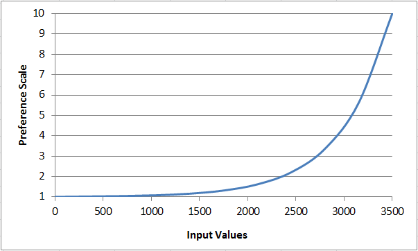
Nonlinear functions can also be applied during data transformation within the Rescale by Function tool. These functions are useful when there is not a linear relationship between preference and data values.
In this example, preference exponentially increases as distance from roads increases. Suitability dramatically improves once a certain distance from roads is reached.
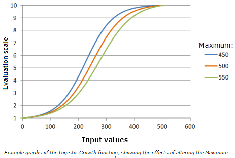
Changing Function Parameters
Accepting the default parameters that are automatically calculated will generate a data dependent scenario (for more information, see the Data Dependency story map). However, parameters can be manipulated to refine the fit of the curve and fine-tune the shape of the curve to best fit the suitability.
Here, an exponential decay of distance from roads with the default parameters accepted.
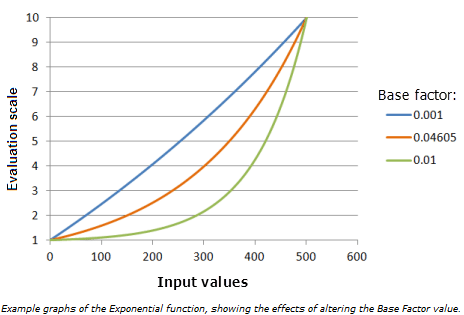
Click below to see when the base factor parameter is adjusted within the exponential transformation:
Exploring Rescale by Function
More options are available for transforming data within a suitability model with the inclusion of Rescale by Function. Multiple functions can be used to better represent phenomena.
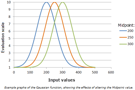
Here, a Gaussian function places high preference on distances from roads that are of medium distance from roads.
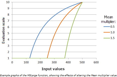
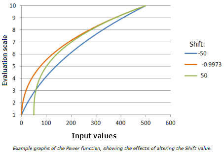
Check out some other transformation functions below:
For a complete list of transformations available in Rescale by Function and details regarding each function, see the documentation.
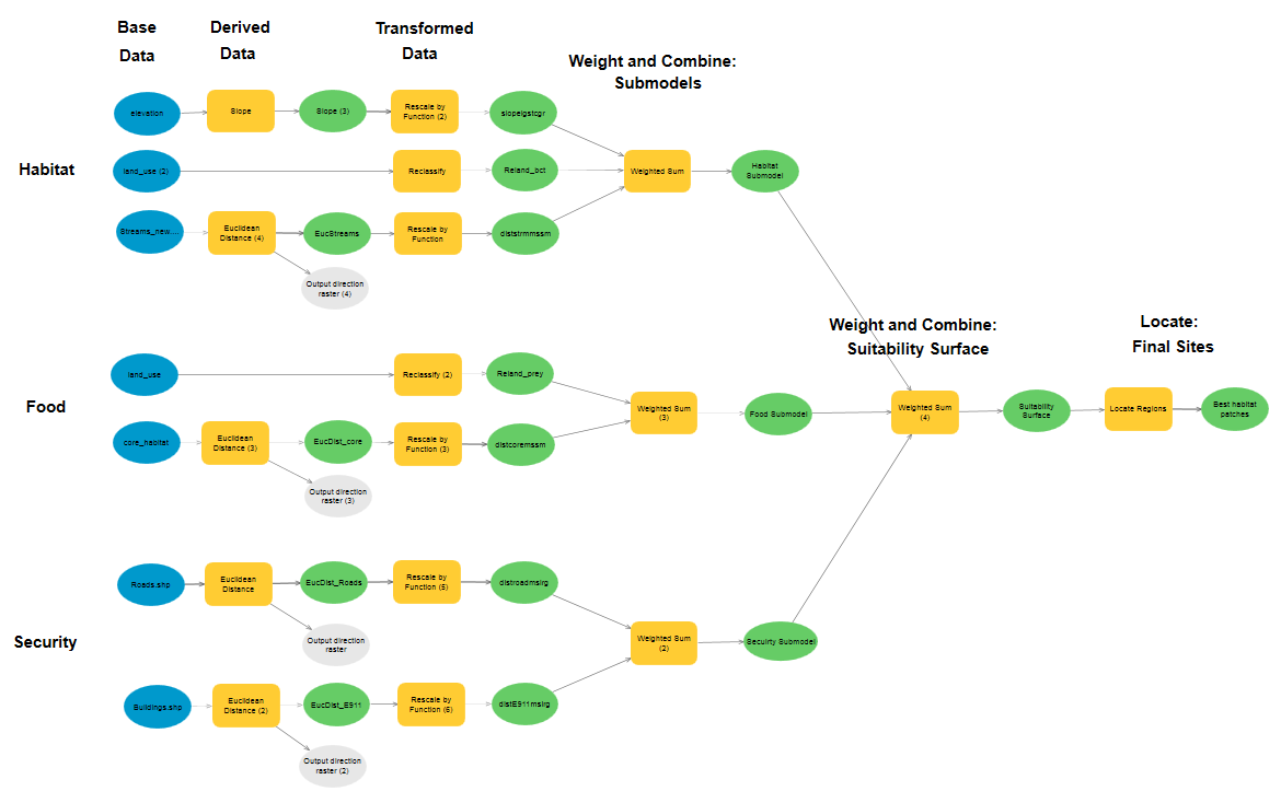
Accurately Modeling the Phenomenon
Appropriate use of the Reclassify and Rescale by Function tools allows ArcGIS users to more accurately model a phenomena.
Below is an example Model Builder model that incorporates Reclassify with discrete data and Rescale by Function for data with continuous values.
Acknowledgements
We thank Steven Lamonde of Johnson State College and the Vermont Center for Geographic Information for their contributions.