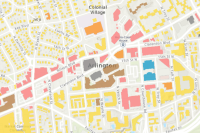
This feature layer, utilizing Federal Emergency Management Agency data, displays footprints for all structures (buildings) greater than 450 square feet in the United States and its territories. A brief summary of the item is not available. Add a brief summary about the item.
Feature layer
by
Item created: Mar 28, 2022 Item updated: Oct 18, 2024 View count: 2,856,690
Description
- As of November 2023, all states and territories include occupancy type.
An in-depth description of the item is not available.
Tables
Basemap
Project Contents:
Solution Contents
Contents
Layers
Screenshots
Terms of Use
 This work is licensed under a Creative Commons by Attribution (CC BY 4.0) license. See Credits and Map for Attribution.
No special restrictions or limitations on using the item's content have been provided.
Details
Dashboard views: Desktop
Source: Feature Service
Creating data in:
Published as:
Other Views:
Dependent items in the recycle bin
Applicable: 2d
Data updated: Sep 10, 2024, 8:13 PM
Schema updated: Oct 15, 2024, 9:03 PM
Size: 0 KB
ID: 0ec8512ad21e4bb987d7e848d14e7e24
Image Count: 0
Image Properties
Layer Drawing
Using tiles from a cache
Dynamically from data
Share
Owner
Folder
Categories
This item has not been categorized.
Tags
homeland security, homeland defense, emergency response, structures, building outlines, USA structures, buildings, FEMA, Federal Emergency Management Agency, ORNL, Oak Ridge National Laboratory, federal, industrial, education, assembly, residential, commercial, U.S. Department of Homeland Security, Department of Homeland Security, DHS, USDHS
Credits (Attribution)
No acknowledgements.Oak Ridge National Laboratory (ORNL); Federal Emergency Management Agency (FEMA) Geospatial Response Office

Comments (34)
Hi, I am trying to perfom a Spatial Join using this layer. I copied and pasted URL layer onto my ArcGIS Pro. When I perform a spatial join, it yields no results. I tried downloading one state (CA, 4 GB) which took 4 hours to download. The Spatial Join worked perfectly. I was just trying to do this analysis without having to download all the state datasets (I am working at a national scale). This is the URL I used. Thanks! https://services2.arcgis.com/FiaPA4ga0iQKduv3/arcgis/rest/services/USA_Structures_View/FeatureServer
Hi Collective Energy. The dataset you are trying to do a spatial join with is very large (125.6 GB) and that may be why you are getting no results. I would recommend you search the Esri Community (https://community.esri.com/) to see if someone else had a similar issue and a resolution. Also, you may contact Esri Technical Support (https://support.esri.com/en-us/contact).
Hello. Is there a way to read this feature layer in FME or download it offline ? I've tried many different methods and keep failing to do so.
Hi Aaron. Yes, you can download the data by using the Export Data dropdown menu on this Items Page. However, the dataset is big and it will take a long time to download. It is better to download a subset of the dataset. You can do this using ArcGIS Pro. Zoom to an area, select the features that you want and run the Copy Features tool (https://pro.arcgis.com/en/pro-app/latest/tool-reference/data-management/copy-features.htm) to download them.
What is the update frequency of this dataset? Is there a particular cadence, or is it constant?
Hi Stace. The is no particular update frequency for this layer. We plan on updating the data after FEMA updates the data sources on their website (see the Data source statement in the Items Page).
I am unable to filter this layer by County FIPS codes e.g., 06085.
Hi Sandra. I just tried to reproduce your issue but was unable to. I filtered using the FIPS field with the value "06085" and it displayed structures in Santa Clara County, California.
Can you clarify the year of the imagery that was used to classify the structures? To JAMALEK79 comment below on Houston -- it would be helpful to know what point in time these structures reflect. Especially valuable for disaster management and understanding what homes may have been built (or destroyed) since this dataset was produced
Hello, FEMA processed ~90,000 images, approximately 1.2 PB with collection dates ranging from 2011–2021. Another reference for the USA Structures dataset would be: A baseline structure inventory with critical attribution for the US and its territories | Scientific Data (nature.com) : https://www.nature.com/articles/s41597-024-03219-x
Thank you for your question. We will investigate.