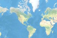
This (v2) vector tile layer provides a detailed basemap for the world featuring a geopolitical style reminiscent of a printed atlas plate or a school classroom wall map. This layer is designed for use with shaded relief. A brief summary of the item is not available. Add a brief summary about the item.
![]() Tile layer
from
Tile layer
from
Item created: May 25, 2018 Item updated: Jan 31, 2025 View count: 2,912
Description
An in-depth description of the item is not available.
Tables
Basemap
Project Contents:
Solution Contents
Contents
Layers
Screenshots
Terms of Use
 This work is licensed under the Esri Master License Agreement.
No special restrictions or limitations on using the item's content have been provided.
Details
Dashboard views: Desktop
Source: Vector Tile Service
Creating data in:
Published as:
Other Views:
Dependent items in the recycle bin
Applicable: 2d
Size: 54.952 MB
ID: 1c365daf37a744fbad748b67aa69dac8
Image Count: 0
Image Properties
Layer Drawing
Using tiles from a cache
Dynamically from data
Share
Owner
Folder
Categories
This item has not been categorized.
Credits (Attribution)
No acknowledgements.Sources: Esri, TomTom, Garmin, FAO, NOAA, USGS, © OpenStreetMap contributors, and the GIS User Community
Comments (0)