This layer presents detailed USGS topographic maps for the United States at multiple scales. This item is in mature support. A brief summary of the item is not available. Add a brief summary about the item.
![]() Tile layer
by
Tile layer
by
Item created: Dec 12, 2009 Item updated: Apr 18, 2019 View count: 43,335,059
Description
Important Note: This item is in mature support as of March 2019 and is no longer updated.
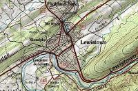
This map presents land cover and detailed topographic maps for the United States. The map includes the National Park Service (NPS) Natural Earth physical map at 1.24km per pixel for the world at small scales, i-cubed eTOPO 1:250,000-scale maps for the contiguous United States at medium scales, and National Geographic TOPO! 1:100,000 and 1:24,000-scale maps (1:250,000 and 1:63,000 in Alaska) for the United States at large scales. The TOPO! maps are seamless, scanned images of United States Geological Survey (USGS) paper topographic maps.
Known Issues: There is a known issue with minor positional shifts (~300 meters) of topo map sheets in the Alaska region. Please be aware if using the topo map for orthorectification or similar purposes.
An in-depth description of the item is not available.
Tables
Basemap
Project Contents:
Solution Contents
Contents
Layers
Screenshots
Terms of Use
 This work is licensed under the Esri Master License Agreement.
No special restrictions or limitations on using the item's content have been provided.
Details
Dashboard views: Desktop
Source: Map Service
Creating data in:
Published as:
Other Views:
Dependent items in the recycle bin
Applicable: 2d
Size: 1 KB
ID: 99cd5fbd98934028802b4f797c4b1732
Image Count: 0
Image Properties
Layer Drawing
Using tiles from a cache
Dynamically from data
Share
Owner
Folder
Categories
This item has not been categorized.
Tags
Credits (Attribution)
No acknowledgements.Copyright: © 2011 National Geographic Society, i-cubed
Comments (8)
good
I have found that the topo is available in printed or pdf form only for certain quads but not all. These are quite valuable maps as on the ground references. The dashed lines for unimproved roads reliably represent historical (and often no longer known of) logging roads. Is there any background information about the vintage of this topo basemap and some link to printed versions?
The available maps do not include this version in many cases. I believe the USA Topo Basemap is based on (taken from) maps published in 1997. You can find 1997 maps for many quads (as example look at SAM Knob, NC). TO the east of Sam Knob is Shining Rock and there's a 1997 map for that quad. But to the north is Waynesville and no 1997 map is available.
This is a good resource for finding lots of individual maps. They'll be attributed with dates. https://ngmdb.usgs.gov/topoview/viewer/#4/40.00/-100.00
Steve, believe me, I understand the "offensive place name" issue. I come across it ALL the time. But, I am an archaeologist and I use these maps to research areas (including one I am working on now) that include racist or offensive place names. These maps are an important resource for detailing the history of a place and people and I am hoping that they do NOT retire the layer so that I can accurately represent history in these areas.
You can download pretty much any historical USGS map here. https://ngmdb.usgs.gov/topoview/viewer/#4/40.01/-100.06
When do you think you will finally retire this layer? In New York, there is at least one offensive place name that needs to go away.
USGS is working on changing names, which is unrelated to retiring an ArcGIS service of historical maps. Here's more information from the US Board of Geographic Names. https://www.usgs.gov/core-science-systems/ngp/board-on-geographic-names/how-do-i