Skip to content
Loading…
This layer is editable and shared with the public. To prevent unwanted editing, unshare this item or approve it for public data collection.
Finish setting up your layer
Describe your item below. Add fields on the Data tab. Configure editing on the Settings tab. Configure drawing and pop-ups through Map Viewer or Visualization tab.

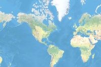
This web map provides a detailed vector tile basemap for the world featuring a geopolitical style reminiscent of a printed atlas plate or a school classroom wall map. A brief summary of the item is not available. Add a brief summary about the item.

‎Web Map from

Managed by

Item created: May 25, 2018 Item updated: Jan 31, 2025 View count: 323,595,837

Snapshot last refreshed:

1882 characters left.

Description

This web map provides a customized world basemap uniquely symbolized. It takes its inspiration from a printed atlas plate and pull-down scholastic classroom maps.  The map emphasizes the geographic and political features in the design. This vector tile layer is built using the same data sources used for the World Topographic Map and other Esri basemaps.  The use of country level polygons are preassigned with eight different colors.  It also includes the global graticule features as well as landform labels of physical features.  This map is designed for use with and includes the shaded relief layer.  

Use this Map

This map is designed to be used as a basemap for overlaying other layers of information or as a stand-alone reference map.  You can add layers to this web map and save as your own map.  If you like, you can add this web map to a custom basemap gallery for others in your organization to use in creating web maps.  If you would like to add this map as a layer in other maps you are creating, you may use the tile layer item referenced in this map.

Customize this Map

Because this map includes a vector tile layer, you can customize the map to change its content and symbology.  You are able to turn on and off layers, change symbols for layers, switch to alternate local language (in some areas), and refine the treatment of disputed boundaries.  For details on how to customize this map, please refer to the Esri Vector Basemap Reference Document (v2) and vector basemap articles on the ArcGIS Online Blog.

Fonts used in this map are under the OFL, Open Font License.

This map was designed and created by Cindy Prostak.

An in-depth description of the item is not available.

Layers

Ground Layers

Tools

Tables

Project Contents:

Solution Contents

Contents

Layers

Screenshots

Terms of Use

This work is licensed under the Esri Master License Agreement.

Alignment of boundaries is a presentation of the feature provided by our data vendors and does not imply endorsement by Esri or any governing authority.

No special restrictions or limitations on using the item's content have been provided.

Comments (1)

Sign in to add a comment.

[Deleted User] Item Owner commented 6 years ago Delete Reply

What are you basing the disputed borders on? Kosovo is not showing and Taiwan is appearing as part of China. Does this follow the US State Dept guidelines or something else?

Item Information

LowHigh

Item Information

LowHigh

Make your item easy to find, understand, and use by providing this information.

    Details

    Dashboard views: Desktop

    Creating data in:

    Published as:

      Other Views:

        Dependent items in the recycle bin

          Applicable: 2d

          Size: 1 KB

          Attachments size: 0 KB

          ID: d582a9e953c44c09bb998c7d9b66f8d4

          Image Count: 0

          Image Properties

          Layer Drawing

          Using tiles from a cache

          Dynamically from data

          Share
          Owner

          Esri Managed by:
          esri

          Folder

          Categories

          This item has not been categorized.

          Assign Category
          Credits (Attribution)
          No acknowledgements.

          Sources: Esri, TomTom, Garmin, FAO, NOAA, USGS, © OpenStreetMap contributors, and the GIS User Community
          URL View
          WMTS View
          Loading…