Classify, optimize, manage and analyze lidar data, model a skymap of sun positions, and process TIN and 3D features with sample tools from Esri's 3D Analysis team. A brief summary of the item is not available. Add a brief summary about the item.
![]() Geoprocessing sample
by
Geoprocessing sample
by
Item created: Feb 13, 2015 Item updated: Aug 17, 2018 Number of downloads: 17,909
Description
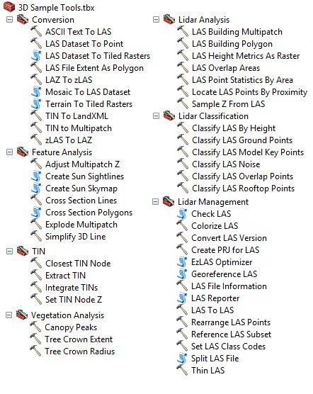
- Classify ground, building, vegetation, and noise points
- Create LAS files with RGB values
- Extract building footprint approximations
- Georeference LAS files collected in local coordinates
- Clip LAS files
- Improve QA/QC processes with lidar data:
- Evaluate LAS files for errors through the CheckLAS utility
- Export LAS file header information
- Define the spatial reference of LAS files with missing/incorrect information
- Project LAS files to desired coordinate systems
- Evaluate coverage of overlaps in lidar scans
- Rearrange LAS files to optimize data access I/O
- Optimize lidar data for operational use and rapid access through the compressed ZLAS format
- Evaluate Z statistics with advanced height metrics
- Analyze the proximity of LAS points to 3D features
- Convert lidar data between various data formats
- Create tiled raster derivatives
- Generate contours along multipatch features
- Determine the shadow cast by multipatch features against a surface model
- Correct the Z value of a multipatch model so that it "sits" on the ground
- Create a point skymap of sun positions for visualization and solar analysis workflows
- Simplify dense, 3D breaklines to support scalability in TIN-based surface modeling
- Integrate a design surface, such as one created using the Grading tool, into a base TIN
- Export a TIN to LandXML for use in 3rd party applications
- Analyze vegetation canopy & crown properties from a surface model
- Cross sections of a multipatch can be used with the Intersect 3D tool to:
- Determine a 3D model's footprint at different heights
- Generate solar sightlines for visibility analysis
An in-depth description of the item is not available.
Layers
Tools
Tables
Basemap
Project Contents:
Solution Contents
Contents
Layers
Screenshots
Terms of Use
The installation will provide the following utilities:
- Check LAS: Validates the data integrity of LAS files and reports .
- EZ LAS: Converts LAS files from and to the ZLAS format.
- LAS Report: Command line utility that returns header information from LAS/ZLAS files.
- 3D Samples Toolbox for ArcGIS Desktop 10.2 - 10.6
- 3D Samples Toolbox for ArcGIS Pro is provided with the Python tools located in the "Pro" directory under the install folder
Please note: The 3D Samples toolbox will be available in the install folder and your "My Toolboxes" directory in ArcGIS Desktop. It can be added to ArcToolbox by following these steps:
- Right-click in ArcToolbox
- Choose the "Add > Toolbox" option.
- Select "3D Sample Tools.tbx" in the installation folder for 3D Samples.
No special restrictions or limitations on using the item's content have been provided.
Details
Dashboard views: Desktop
Source:
Creating data in:
Published as:
Other Views:
Dependent items in the recycle bin
Applicable: 2d
Size: 3.222 MB
ID: fe221371b77940749ff96e90f2de3d10
Image Count: 0
Image Properties
Layer Drawing
Using tiles from a cache
Dynamically from data
Share
Owner
Folder
Categories
This item has not been categorized.
Tags
3D Samples, Lidar, Sun Position, CheckLAS, EzLAS, mosaic dataset, LAS, LAS dataset, TIN
Credits (Attribution)
No acknowledgements.Clayton Crawford, Khalid Duri, Jie Chang, Esri
Comments (75)
I found a solution. After downloading the exe file, I simply right-clicked the file and extracted it using 7zip (Any zip utility will work, I gues, including Windows Explorer native zip extraction utility). After unzipping, simply open the extracted folder and you should see the 3D sample toolbox and the other utilities that come with the package. Follow the instructions in the post for adding the toolbox to Arcmap.
We have the same problem. No 3D Samples Toolbox after installation. We use ArcGIS10.8.1. Please assist.
after the installation, I have just Check LAS, EZ LAS and LAS Report, but Not 3D Samples Toolbox? I don't know if someone encounter this problem as well?
Is there an updated version of this toolbox? I need to use the LAS Dataset To Tiled Rasters tool to create a DSM.
In the Lidar Management: Georeference LAS tool, what are the source feature and the reference feature referring to? Is it possible just to draw two line features on a map and enter them into the parameters?